Technical Guide · Free Flight

Paragliding aerology to understand the air for to fly better

The phenomena that make a wing fly — or put it at risk, a five-step analysis method for deciding whether to go ahead or not, and the tools designed for paragliding. A field guide by DEJEPS-qualified instructors who have been flying Gréolières for years.

  • Phenomena explained without jargon
  • GO / NO-GO Method
  • Dedicated weather tools
  • By DEJEPS monitors
Paragliding aerology: interpreting the sky and clouds before a flight above Gréolières Aerology · Cheiron
  • Scalefirst 3,000 metres
  • Make it flySea Breezes · Thermal Breezes · Dynamic Breezes
  • To avoidFoehn · Rotor · Shear
  • DecisionGO / NO-GO Method
  • Prohibited vent25-30 km/h at altitude

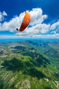
Aerology studies small-scale air movements – exactly what makes your wing go up, down, or toss you about in a gust. Meteorology looks at the atmosphere from afar; aerology looks at what’s happening just above your head, in the first 3,000 metres. For a paraglider pilot, that's half the job. The other half is piloting.

This guide meets three needs: understanding the phenomena that make a wing fly (or put it in danger), knowing how to analyse a weather situation before taking off, and finding the right resources to improve. Sea breezes, thermals, foehn winds and instability explained without jargon, a five-step method, and an overview of dedicated tools.

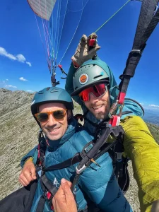
This content is written by the team at'Accessories, paragliding school based in Gréolières (06) since 2013. Pierrot, the founder, is a DEJEPS-qualified instructor and has been flying at this site for 19 years. The examples are drawn from this experience: what you actually see in the air at Gréolières, to Gourdon, to Roquebrune-Cap-Martin.

Paragliding using a thermal above the valley, aerological site reading
Scale question

Aerology or meteorology: what exactly are we talking about?

Many pilots use the two words interchangeably. They are not: the difference lies in the scale of observation. Meteorology tells you if you can fly today; aerology tells you where, when, and how.

Large

Meteorology observes the atmosphere from afar

Anticyclones, depressions, fronts, air masses crossing continents: this is what you see on a map of France. Useful for knowing if the weather will be nice in Nice this weekend, but insufficient for preparing a flight. Without the weather, you take off by Föhn without realising it.

In small

Aerology looks at the air locally

How air behaves in a valley, on a slope, around a summit: breezes that change during the day, thermals over a heated field, accelerated currents in a gorge. This is «micro-aerology» – what's happening right under your nose, which no national map can predict. Without meteorology, you won't understand why it picks up at 11 am and dies down at 1 pm.

Ascendancies

The phenomena that allow a paraglider to fly

A paraglider flies because air is rising. This air can rise for several reasons: knowing which ones it is, is knowing where to find thermals and how to exploit them.

Breezes

Slope and valley breezes

When the sun heats a slope, the air rises up the incline — the Slope wind, rising during the day. At Gréolières, it is felt around 10 a.m. on the southern slope of Cheiron. The valley breeze It ascends the valley by day and overlays itself: a site oriented in the direction of the valley provides more favourable conditions.

Thermals

Thermals, the basis of flight

A hot air balloon that lift off the ground: fields, rocks, car parks, villages trigger thermals. They are identified by the beep of the variometer, sometimes by eye by a cumulus cloud. A good summer thermal in the Alpes-Maritimes rises to 2 or 3 m/s. We centre it by turning flat - this is the basis of thermalling and cross-country flying.

Dynamic

Dynamics and convergences

When a steady wind encounters relief, it is deflected upwards: this is orographic lift dynamic. A wing can fly without thermals, facing the slope – Roquebrune-Cap-Martin operates like this in winter with the sea breeze. convergences (two air masses meeting) lead to long ascents, greatly exploited in cross-country flying.

Vigilance

The phenomena that make a flight dangerous

The air that makes you fly is the same that can get you into trouble. It all depends on the intensity, the direction, the stability. Here are the phenomena to recognise before they recognise you.

Absolute no-go

The Foehn

A wind that crosses a landscape, dries up and arrives Hot, dry, strong, turbulent. In the Alpes-Maritimes, the Italian foehn is sweeping down over Gréolières. It can be recognised by a very blue sky, unseasonably warm air, and trees swaying without any distinct gusts at ground level — at 1,800 m, winds can reach 50 km/h without warning. Foehn forecast: We're not getting off the ground..

Intensity

Instability, gradient, and shadows

A strong instability gives violent thermals, or even thunderstorms (cumulonimbus): above 6 m/s, it's best to avoid if you're not an experienced pilot. gradient (wind-to-ground/altitude difference) causes the wing to «drop» on landing: caution above 15 km/h, cancellation above 25. A Shadow Cloud = descent, the wing can lose 100 m: stay in the sun.

Turbulence

Rotor and shear

A rotor is a vortex in the lee of a landform, very dangerous: clouds that «roll,» a flag that spins, brutal turbulence – one never flies in the lee of a ridge in strong winds. The Shearing is a sudden drastic change in the wind over a few metres («like hitting a wall»): the wing is shaken, it can collapse. An instructor teaches how to anticipate them by eye.

GO / NO-GO

Analysing the weather before a flight: a 5-step method

A serious analysis isn't done in the morning in the car park: it starts the evening before and finishes at take-off. Here's the method we apply at the school to decide on a GO or NO-GO.

Steps 1-2

Synopsis then dedicated tools

The night before, watch the synoptic situation (anticyclone, front, pressure) on Météo France or Météociel. Then, on your paragliding tools, check three parameters for your time slot: the flight level (NO-GO if > 25-30 km/h), the Ceiling and clouds (cumulonimbus = thundercloud = mamma), the'instability index.

Steps 3-4

Observe the pitch, 5 mins before

On-site, watch Flag, smoke, branches, ripples on a lake give you the real wind – compare it to the forecast. Before you inflate, take 5 minutes: windsock, ask pilots already airborne, observe the sky. If nobody is flying, there's often a reason. Don't go off on your own to an unknown site without asking a local.

Step 5 · Decision

GO ou NO-GO

Go yes: wind in the right direction and strength, stable conditions, wing and pilot ready, landing accessible. NO-GO As soon as even one parameter is red (wind too strong, crosswind, sky darkening, doubt, fatigue, equipment not fresh). A good day not flown is worth a thousand times more than a flight that goes wrong.

Toolbox

Weather tools for paragliding

Météo France is sufficient for knowing if it's raining; to prepare for a flight, you need tools that cover aerology, cloud ceiling, high-altitude wind, and instability. Here are the ones that count — and the golden rule: always cross-reference at least two tools.

The reference

Paragliding weather

Built by and for pilots: wind by altitude band (1,000, 2,000, 3,000 m), forecast cloud base, convection index, thermal zones on map. Quick to read, intuitive colour coding, free in basic version. If you only use one tool, this is it.

Overview

Météoblue & models

Météoblue Hourly forecasts for 7 days, meteogram, and wind charts. The models AROMA (fine mesh 1.3 km, 36 h) and ARPEGE (4 days) refine the forecast on Météociel. The radiosonde soundings (Skew-T)s are the tool of the experienced pilot for reading instability and inversions.

Real time

Webcams and local weather stations

A Webcam Based on your website, it's better than a model: actual cover, cloud base, tree swaying. Combined with a Local station (Pioupiou, Holfuy) provides live wind updates. On Gréolières and most websites in the 06 area, the webcams can be accessed in just a few clicks. Always cross-check a model with on-the-ground data.

With Ailéments

Making progress in aerology: where to start

Aerology isn’t something you learn from a book: you learn it in the air, by repeating flights at the same site and comparing your predictions with what you actually experience. Theory helps you learn faster. Three practical starting points at Ailéments.

Instructional tandem flight: experiencing aerological phenomena with commentary from an instructor

To feel on an introductory flight

Le educational flight Place the monitor beside you: he explains in the air what he reads from the sky and why he makes certain decisions. The best way to feel breezes and thermals before the theory.

The training flight
Shuttle Gréolières: access to the Crêtes take-off point for licensed independent pilots

Flying frequently, to the same destinations

Repetition teaches the eye. For licensed pilots, the shuttle Gréolières Take off from the Crêtes or the 300, on one of the most generous sites in the Alpes-Maritimes. Fly in a group, ask questions, watch where the locals choose to turn.

The shuttle
The Ailéments School

What separates a flight that has been executed from a flight that has been decided

Aerology isn't optional for a pilot: understanding phenomena, analysing the weather, cross-referencing the right tools, and above all often flying over the same sites with pilots who know how to read the sky. Five minutes of debriefing over coffee sometimes teaches more than an hour of PDFs.

The Ailéments team has been flying to Gréolières since 2013, supervised by Pierrot (DEJEPS, 19 years of experience on the site). Whether you want to experience, structure, or practice, there is a suitable entry point.

Flying with an instructor
DEJEPS Ailéments instructor checking the sky before a flight at Gréolières
Experiencing aerology

Feel the air, don't just read it

From thermal flying to training courses, the best ways to put aerology into practice with a DEJEPS-qualified instructor at Gréolières.

Paragliding

Ascending flight

20-30 min · Thermal runaway

140 €
Paragliding · Long

Prestige flight

45-60 mins · At the heart of the thermal springs

250 €
Training · 5 days

Introductory course

Aero theory + practice

as soon as 690 €
On video

Our video flights

Training courses and introductory flights on Gréolières: an overview of the flight conditions we check every day.

Courses and introductory sessions on Gréolières

Frequently asked questions

Questions about aerology for paragliding

Phenomena, flight decisions, equipment: answers to the most frequently asked questions about paragliding.

Quelle est la différence entre aérologie et météorologie ?

Meteorology looks at the atmosphere on a large scale (anticyclones, fronts): it tells you if you can fly today.'aerology look at the local air, within the first 3,000 metres (breezes, thermals, valley winds): it tells you Where, when and how. The two are read together.

What makes a paraglider rise?

Where there's smoke, there's fire: Slope wind (heated air rising up the slope), the valley breeze, the thermal (parcels of hot air detached from the ground), the dynamic (wind deflected by relief) and convergences. A good summer thermal in the Alpes-Maritimes rises to 2 or 3 m/s.

What is a foehn wind and why is it dangerous?

Le Foehn is a wind that blows across the landscape, dries out and arrives hot, dry, strong and turbulent. In the Alpes-Maritimes, it descends from Italy over Gréolières. It can be recognised by a very blue sky, unseasonably warm air, and trees swaying without any gusts at ground level — at 1,800 m, it can reach speeds of up to 50 km/h without warning. Foehn forecast: no take-off.

How to decide on a GO or NO-GO before a flight?

A 5-step method: the synoptic situation the day before, dedicated tools (wind at flight altitude, ceiling, instability), ground observation compared to forecasts, and 5 minutes before inflating (windsock, sky, other pilots). Go if everything is green, NO-GO as soon as a setting is red.

What weather tools should I use for paragliding?

Paragliding weather is the reference (wind by altitude, ceiling, convection). Météoblue This gives the overview. The AROME and ARPEGE models refine the forecast, radiosonde data is for experts. Webcams and local stations (Pioupiou, Holfuy) provide live wind data. Always cross-reference a model with ground truth data.

What is a thermal in paragliding?

A thermal is a bubble of hot air that detaches from the ground and rises. Fields, rocks, car parks, villages – anything that heats up faster than its surroundings triggers them. They are identified by the beeping of the variometer, sometimes visually by a cumulus cloud. A good summer thermal rises at 2 or 3 m/s; it is centred by turning flat.

How to improve at aerology when you're a beginner?

It is learned on the fly, by repeating flights at the same site. For beginners, it comes with the piloting during the training (theory validated by FFVL patent). After the licence, a dedicated course trains you to read the sky. Fly often, in groups, with pilots who know how to read the sky: Repetition trains the eye.

From what wind direction should one not take off?

A wind at flight altitude beyond 25-30 km/h is a NO-GO on most sites. On the ground, a gradient of more than 15 km/h over 100 m requires caution, beyond 25 km/h it's cancelled. Absolute NO-GOs are added: forecasted Foehn, cumulonimbus (storm), crosswinds, or any doubt about stability.

Written by the team Ailéments — DEJEPS instructors, Gréolières school

Paragliding school based in Gréolières (06) since 2013. Pierrot, the founder, is an instructor DEJEPS and has been flying at this site for 19 years. The examples in this guide are drawn from that experience: what you actually see in the air at Gréolières, Gourdon and Roquebrune-Cap-Martin.

DEJEPS Monitor 19 years on the site +1070 5/5 reviews Gréolières 1,800 m
The essentials

Aeriology: what you need to know

Understanding the air is what transforms a performed flight into a mastered flight.

1

Aerology ≠ meteorology

The weather says yes you can fly; aerology says Where, when and how, on a local scale of the first 3,000 metres. The two are read together.

2

To know what makes something fly... and what threatens it

Breezes, thermal, dynamic and convergences cause the wing to rise. Foehn, strong instability, gradient, rotor and shear are the phenomena to recognise and avoid.

3

A GO / NO-GO method

Synopsis the day before, dedicated tools, field observation, 5 minutes before inflation. NO-GO as soon as a single parameter is red A day not stolen is better than a botched robbery.

4

Flying often remains the key

Cross Meteo-parapente, Météoblue and a webcam, but most importantly fly to the same places with pilots who know how to read the sky. Repetition teaches the eye.